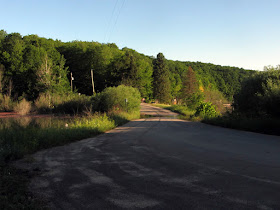
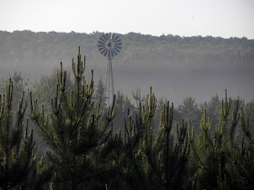
Photos from 2014 and later.
Four of northern Michigan's major rivers find their sources within the county—the AuSable River, Black River, Pigeon River, and Manistee River—which undoubtedly contributed to its popularity for logging in the late 1800s. As the timber was cleared Otsego County became famous for potato growing, and later boasted one of the larger oil fields in the state.
Among the things I had wished to see in Otsego County was the remnants of the old "Glass Bottle Fence" along Old 27 near the town of Waters, but sadly I was informed by a colleague that it was destroyed awhile ago during road construction. There were also the ghost towns of Johannesburg and Sparr, and somewhere I had heard there was an old ski resort that was abandoned, with chairlift and everything still there, but I never did find out where that was. That would have been a good one to get, since hilly Otsego County is a center of the skiing business in Michigan.
I did happen to pass through Gaylord's outskirts one day on I-75 and in the distance I saw a large (modern) factory being torn down, so I made a mental note to check it out later. But on my return trip a few days later I was surprised to see that nothing was left except a blank foundation. Nonetheless I figured checking out the ruins might be worthwhile, so I walked up the train tracks onto the property.
As it so happens, the 45th Parallel passes right through the middle of this plant. Extra geography nerd points for this one, obviously! But there was not a lot to see I'm afraid, and worse yet, the gate was tightly locked.
My colleague Navi informs me that this plant was built in 1965 by U.S. Plywood, as the largest particleboard factory east of the Mississippi. It was last operated by Georgia-Pacific in 2006. So when even the plywood factory closes, you know the economic recession is bad...since I mean, whose gonna make the plywood to board up all the vacant houses in Detroit-Flint-Saginaw? Am I right?
Anyway, some six miles from Gaylord lie the last remnants of the town of Hallock...
Hallock was founded in 1906 and named for Benjamin Hallock, a farmer whose land was crossed by the Boyne City, Gaylord & Alpena Railroad line passing through the town. At its peak, there were three stores, a church, a train depot, a school, and a Gleaner's Hall in town, which was used for recreation. The post office of the short-lived town closed in 1914, and it faded out of existence completely by the 1920s.
Author Roy L. Dodge writes that Robert Moorehead taught school in Hallock and described it as a thriving community in 1914, but it faded quickly soon after that. Kenneth Shue of Harrison bought the whole town in 1928 for $10 (by then almost nothing was left), and he proceeded to let it go back to nature—and to the tax assessor for nonpayment. Today the vicinity is still populated by a couple occupied farms.
In its day lumbering and farming were the primary economic activities in Hallock, with the farmers finding work in the forests to supplement their farm's income during winter lulls. There was also a sawmill, a feed mill, and a potato warehouse in the vicinity of Hallock.
The first thing I found in Hallock was this old ruined structure that sat in the midst of an old farm field, currently still partly shrouded in the purple mist of a summer morning.
It had a weird, well-weathered tin wall covering on the exterior that was stamped to make it look like a brick wall:
I got my pants soaked quickly from the morning dew, just by walking up to the fallen structure in the deep grass.
I'm not sure what it was, but most likely part of someone's old farm.
Here is a photo of Hallock c.1920, from Roy L. Dodge's book:
Nearby was a super-creepy old twisty road that wended its way in amongst a dense grove of tall hardwoods, curiously illuminated by the rising sun:
This wasn't really the way I was intending to go, but it was so enchanting that I had to follow it for a bit...
Soon, a sign informed me that I had reached the small Hallock Cemetery, of Elmira Township.
Through the morning glare I perceived the outline of an old farmhouse in the overgrown woods across the street...
Surely, this must have once been part of the town of Hallock, since it is definitely from that time period or older.
The village schoolteacher mentioned earlier, Mr. Moorehead, said that Hallock got its name because of the land donated by farmer Benjamin Hallock to build it. When Roy Dodge's book Michigan Ghost Towns of the Lower Peninsula was printed in 1971, he wrote that Benjamin Hallock's house was the only one left standing in the town that bore his name...I wonder if this is it, still here almost 50 years later?
Uh-oh, someone left a door open...you know what that means.
But this was a true cellar, not a full basement, so there were no stairs leading up into the house. Sorry if you were getting excited. You know, according to linguists (most notably J.R.R. Tolkien), the words "cellar door" are together considered the most phonaesthetic phrase in the English language, in other words, the most beautiful-sounding to hear and to say. And now I bet you won't ever be able to look at a cellar entrance again without thinking about that useful little tidbit.
I went back out to finish my circle around the outside.
According to another book by Larry Wakefield, Hallock also had one of the only two gold mines ever registered in Michigan's Lower Peninsula. There were several reasonably successful ones in the Upper Peninsula (as I have written about before), but the two efforts in the Mitten were much less so. Besides Hallock, the other was in Alcona County (which I also wrote about before), and both were probably hoaxes.
Anyway, in 1911 farmer Charles Hatch found flakes of gold in some water running off of his field in Hallock, and had it assayed at $3.50 to the ton. Soon after he let out his little secret to the newspapers, it was learned that the Jackson, Lansing & Saginaw Railroad still owned the mineral rights to the land where the gold was found...
Soon two mine shafts were sunk, and heavily shored for the soft soil. Local Marvin Kelso says that they never got any deeper than 100 feet however because that's where the water table was, and the effort was abandoned as fruitless before any pumping equipment was installed on site.
It has been suggested that this mine was a hoax, perpetrated by the railroad to attract investment (or to inflate its value on paper in anticipation of a coming buyout) by producing the fraudulent gold flakes, perhaps with farmer Hatch as a willing accomplice. I'm sure that any geologist with knowledge of Lower Michigan would agree that there is no gold anywhere near here.
Back on the road.
LOL I thought this road was supposed to take me back to I-75, but here I am staring at it from about 20 feet above highway grade. By the looks of all those tire tracks, I'd say I'm not the only one who got duped...and I use paper maps.
I did plenty of driving around elsewhere in Otsego County—as I usually end up doing before I feel I've gotten enough material to write a post—and there were a couple other minor things I took pictures of, but this seems like a good place to leave off. Sometimes it takes a couple years worth of traveling through or across a certain county before I have accrued enough to write about, and Otsego was one of those instances. Long story short, I have done a LOT of wandering across this great state.
References:
Michigan County Atlas, 2nd Ed., by David M. Brown, p. 144
Michigan Ghost Towns of the Lower Peninsula (II), Roy L. Dodge, p. 148 & 152
Ghost Towns of Michigan, Vol. 2, by Larry Wakefield, p. 27-31
https://www.woodworkingnetwork.com/woodworking-industry-management/wood-waste-biofuel/Huge-Vacated-GP-Particleboard-Mill-Being-Demolished-202852221.html
Michigan Ghost Towns of the Lower Peninsula (II), Roy L. Dodge, p. 148 & 152
Ghost Towns of Michigan, Vol. 2, by Larry Wakefield, p. 27-31
https://www.woodworkingnetwork.com/woodworking-industry-management/wood-waste-biofuel/Huge-Vacated-GP-Particleboard-Mill-Being-Demolished-202852221.html


YUGEST PAHHTICLEBOAHD PLANT EAST OF THE MISSISSIPPI!
ReplyDeletehttps://www.woodworkingnetwork.com/woodworking-industry-management/wood-waste-biofuel/Huge-Vacated-GP-Particleboard-Mill-Being-Demolished-202852221.html
Good sleuthing.
Delete